Zion National Park Map | Map of Zion National Park, Kolob Canyons & Zion Canyon
Zion National Park Map
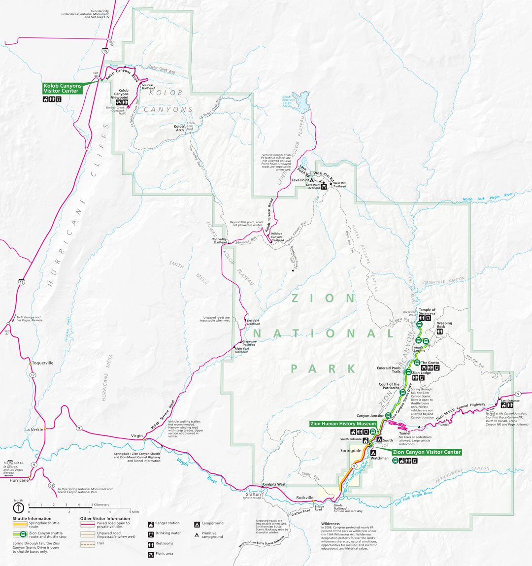
Click on the image below to download a PDF of this map of Zion National Park
Click on the image above to download a PDF of this map of Zion National Park
Located in Washington, Iron, and Kane Counties in southwestern Utah, Zion National Park encompasses some of the most scenic canyon country in the United States. Within its 229 square miles are high plateaus; a maze of deep, narrow sandstone canyons; and the Virgin River and its tributaries. Zion also has 2,000-foot Navajo Sandstone cliffs, pine- and juniper-clad slopes, and seeps, springs, and waterfalls supporting lush and colorful hanging gardens.
With an elevation change of about 5,000 feet from the highest point at Horse Ranch Mountain (at 8,726 feet) to the lowest point at Coal Pits Wash (at 3,666 feet), Zion’s diverse topography cultivates a diversity of habitats and species. Desert, riparian (river bank), pinyon-juniper, and conifer woodland communities all contribute to Zion’s diversity. Neighboring ecosystems such as the Mojave Desert, the Great Basin, and the Rocky Mountains are also contributors to Zion’s abundance.
The park has more than 1,000 species of plants ranging from tall, graceful cottonwoods growing along the river to towering pines and firs shading the higher elevations. Prickly pears, cholla, and yucca are among Zion’s desert-adapted plants. The hanging gardens support brilliantly-colored Zion shooting-stars, scarlet monkeyflowers, and Western and golden columbines.
In turn, Zion’s plant communities provide food, shelter, and nesting places for Zion’s diverse wildlife. There are approximately 67 species of mammals, 29 species of reptiles, seven species of amphibians, nine species of fish, and 207 species of birds. Endangered California condors soar above the cliffs of Zion; threatened Mexican spotted owls — Zion has the highest density of these owls breeding in the state — live and raise their young in Zion’s narrow canyons.